Business Outline
ICT and Geomorphic
 |
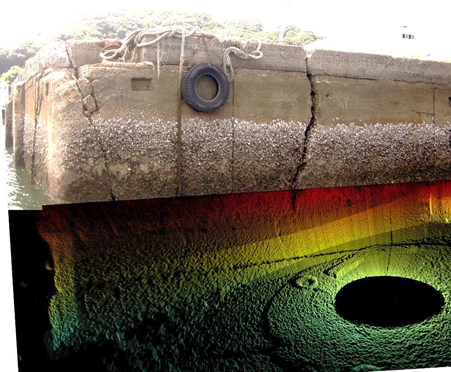
| Aquatic structure depicted by 3D-imagery |
|
・Aquatic structure
・Geomorphic investigation by detailed echo sounding
・Geological survey ( sonic , magnetism)
・Shoreline survey (coastal landform, Longitudinal and cross-section surveying )
・Control point survey, leveling, flat plate survey |
・ADCP and multi-beam
・Drawing bathymetric map, isobath diagram and longitudinal section/cross-sectional drawing
・Drawing and correction with all-purpose CAD
・Output of 3D bathymetric chart |
 |
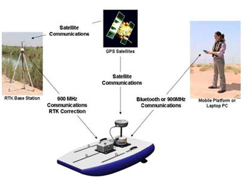
| System of geomorphic investigation & flowing investigation by small ship |
|
 |
| Scene of surveying the depth measurement |
|
|
© 2025 SEIBU Environmental Research Co.,LTD. All Rights Reserved.